-
 Virginia authority works to give boaters more launching options
Don't know if anyone fishes Delmarva in here, but my friends have a house in Loudon County. Whenever I visit, I try to hit the salt. That just got easier, was reading this article. They talk about boat launches, but we kayakers use them also.
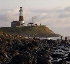
GLOUCESTER - The end of Kings Creek Road deep in Gloucester's Guinea is a little-known public boat launch that's also serving as a waterfront dump.
The collection of trash in the grass along the road includes empty bottles of Bud Light, quart containers of Marva Maid 2% milk and a half-dozen packs of empty Basic Lights cigarettes. Rotting carcasses of filleted fish down by the water — heads, bones and tail are all that's left — are testament to a good day's catch.
But someday it may be a rustic boat launch with picnic tables, trash receptacles and a reputation as a good place to put in.
The boat landing, known by locals as Bill Hogg's Landing, is among more than 300 state roads that end at rivers, creeks and bays throughout the Middle Peninsula that are owned or have easements that have been obtained by the Virginia Department of Transportation. A handful like Bill Hogg's Landing are already used as public boat landings.
But now a movement is afoot to transfer ownership of some of the road endings to an entity called the Middle Peninsula Chesapeake Bay Public Access Authority. The authority would help manage the properties — in some cases clean them up — and make them more widely known in hopes of giving residents more access to waterways.
The authority was established by the General Assembly in 2002 and ratified by eight participating localities in 2003. The members include the counties of Gloucester, Mathews, King and Queen, King William and Essex, and the towns of Urbanna, West Point and Tappahannock.
The authority was established to identify, acquire and manage public water access opportunities in the region that can be used by the public for recreational activities such as boating, fishing, kayaking or canoeing.
Transferring the properties to the authority isn't necessarily an easy undertaking, however. The authority hired a consultant in 2006 to identify the owners of five road endings: Bill Hogg's Landing, called Lower Guinea Landing by the authority; Roane Point Landing in Mathews; Ferry Landing in Essex; and Chain Ferry Landing and Byrd's Bridge Landing in King and Queen.
Sorting out ownership and easements by poring through old documents is a complicated undertaking.
The consultant's report on Bill Hogg's Landing concluded, after checking records dating back to the 1860s, that the public has a right to a 30-foot-wide stretch of unimproved road down to the water.
"They're all like that," said Lewis Lawrence, a staff member of the access authority. "It's just a crazy circus of trying to capture 300 years of who owns the property and where you're going to go with it."
To transfer the land, the authority will have to hold a public hearing and notify the Gloucester Board of Supervisors, nearby landowners, VDOT and the Virginia Department of Game and Inland Fisheries of its intentions. After the public hearing, the authority will send VDOT a transcript of the hearing, the comments received and include its formal request for the transfer of the landing.
The Commonwealth Transportation Board would transfer its interest to the public access authority, a process that could take up to a year in the case of Bill Hogg's Landing, Lawrence said.
No major improvements are intended for the landing, Lawrence said, other than picnic tables, trash cans and signs directing the public to the landing.
Gloucester County Supervisor Louise Theberge said many people don't even know about the end-of-the-road access points.
"It is getting harder and harder to find the places to push your canoe over or put your kayak in," she said.
The idea is to identify the public access points and keep them in public use.
"Local people know about it, but a lot of other people don't," she said. "They are being used by the public, but they just aren't being used by the general public at large."
Local dollars aren't funding any of the access authority's projects. State, federal and private grants and funding have comprised much of the $2.9 million in funding the access authority has received since 2003.
Projects have included acquiring and opening to public access up to 600 acres in the Dragon Run watershed and 247 acres known as the Browne Tract straddling Essex and King and Queen counties that has 7,500 feet of water frontage on the Dragon Run Swamp. The Browne Tract is open to the public for hunting, biking, hiking, fishing and other recreational activities. The authority is also soliciting the public's comments on water access. To participate, go to: www.wateraccess2007.com/ survey.htm.
There is s lot of access there now, but it's sometimes confusing. Setting up maps and such will make it easier. Maybe putting in some trash cans also will motivate people to use them. 
 Posting Permissions
- You may not post new threads
- You may not post replies
- You may not post attachments
- You may not edit your posts
-
Forum Rules


 Reply With Quote